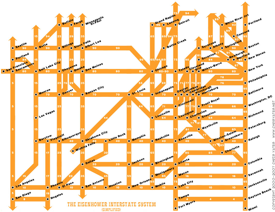
The US Interstate Highway System Map by Chris Yates
 Tuesday, February 13, 2007 at 3:27PM
 INFO VISUALIZATION: Well, here I am, back from the dead. :-)
Work, work, work and some of my projects (a new source code community wiki, a place to buy historical stock quote data en masse (still being built), and a place for historical price data for consumer goods (still in the early stages)) have been keeping me from blogging for almost a year.
BUT, here I am, to show you a great new map of the US Interstate system. Enjoy!

Reader Comments (3)
you ought to put Buffalo NY in between Cleveland and Syracuse on the 90
Excellent... very good concept. One problem I noted is that I-70 does not run through Harrisburg, the PA turnpike through that stretch is I-76. I-70 starts in PA west of Harrisburg south of Breezewood
Wow great post! I really wanted to see a map of the US Highway System! Thanks!